Run instant site assessment and due diligence with 50+ data layers
Evaluate zoning, wetlands, and future land use instantly to ensure the deal pencils out before you commit resources
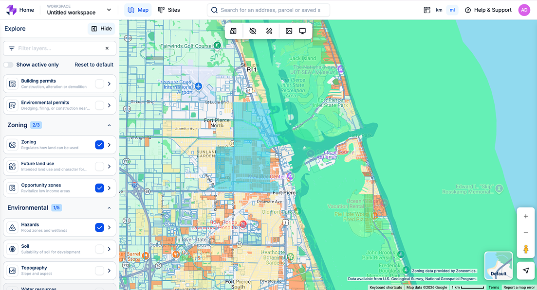
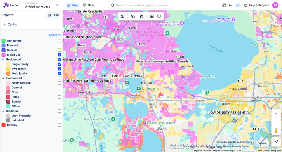
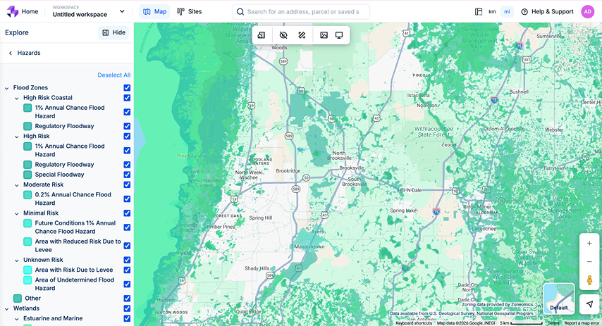
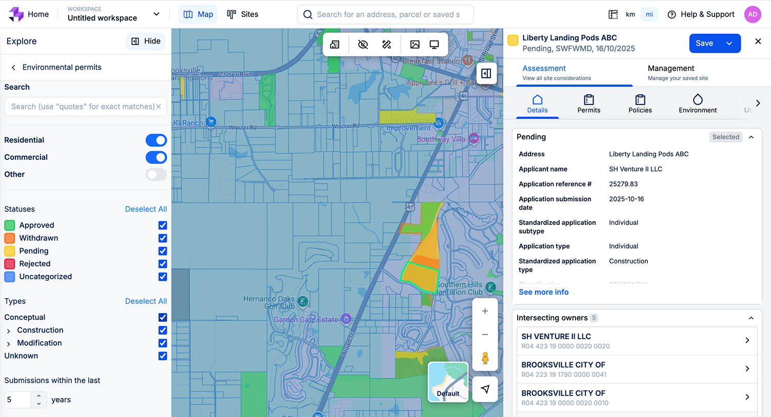
Replace the "five-tab workflow" for site assessment.
Stop wasting hours jumping between county zoning portals, FEMA flood maps, and spreadsheets just to run a preliminary evaluation. LandTech overlays 50+ crucial data points onto one interactive map.
Uncover everything you need to know about a parcel
Entitlement data
Instantly check current zoning and Future Land Use (FLU) designations to confirm development potential.
Environmental overlays
Spot deal-killers early with detailed wetland coverage and flood zone mapping.
Early market indicators
See recent rezoning applications and Environmental Resource Permits (ERPs) before they hit the open market.
A platform that grows with your team.
Onboarding was simple, fluid, and clear. There’s no wasted space here - just a powerful program that scales with your team’s needs. From CRM basics to advanced site-planning tools, it gives us exactly what we’re looking for. Highly recommended for any team that wants technology that grows with their business.
John Buzzy
Land Acquisition Manager, Pulte Group
Used by leading companies
Move faster, earlier, and with confidence.
Confident underwriting
Get the hard data you need to run accurate financial models and ensure the deal stacks up.
Spot deal-killers fast
Quickly disqualify sites with poor net developable acreage or massive fill requirements.
Win land committee
Prepare robust investment packs backed by comprehensive, up-to-date local data.
Real data. Real stories. Real results.
0
Identify land 8x faster than manual research.
0
4/5 users said this reduced acquisition time by up to 40%.
0
Used by 2,500+ of the world's largest developers to streamline land acquisition.
Source better parcels, faster:
Identify off-market opportunities 10x faster than manual research using smart filters for zoning, FLU, and constraints.
Make confident decisions early
Access 50+ data layers instantly to underwrite deals and ensure the numbers pencil before taking them to the land committee.
Collaborate across divisions
Ditch the spreadsheets and manage your deal flow in a cloud-based pipeline that gives everyone real-time visibility.
Take the guesswork out of your land committee packs
Use 50+ data layers to spot deal-killers early and ensure every site you pursue is truly developable.
Start assessing parcels now
Enter search term